


We have information for Lyon County including
- Searchable Lyon County Assessor Records
- Searchable Lyon County Sales Records
- Searchable Lyon County Recorder's Files
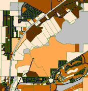
- Lyon County Assessor Plat Maps
- Lyon County Large Format Record Maps
- Lyon County Recorded Documents
- Lyon County Assessor House Photographs
- Navigable Lyon County GIS
Searchable Lyon County Assessor Records
Our reports are designed to save you time and hold as much information as possible. They include on them all the information that can be extracted from the county databases, formatted for easy reading.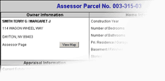 We realize that you need hardcopies of this information as well, and we have designed all our reports so they will fit on regular 8.5" by 11" letter-size paper.
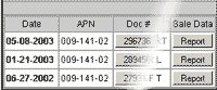
All of the reports are cross referenced to the related recorded documents, sales information, maps and photographs.
Cross-Referenced Maps
Often, you may need to access the parcel maps related to the report being viewed. We have done our best to make it easy to bring up the related document, which we dislpay in an easily-printable pdf format. All of our map images are high-quality, large-format scans that can be reproduced at original size on a plotter, or automatically reduced for use on regular letter-format paper.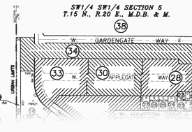
Recorded Documents
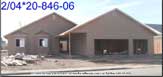
We have 50,000 scanned recorded documents for Lyon County, from marriage certificates to deeds and every thing else, all of which can be printed on standard letter size paper.Assessor Property Photographs
Highly Accurate GIS